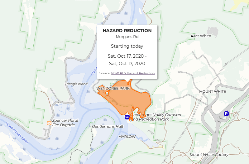
Adding NSW Hazard Reduction Burns to the Map
Posted
We are well and truly into hazard reduction season now. After planning out a walk, travelling to the start only to discover a prescribed burn taking place I knew I needed to improve BeyondTracks. For a long time we’ve shown active fires from NSW RFS, but this didn’t show areas planned for hazard reduction before the burn started. So from today we show planned hazard reduction burns for NSW on the map.

The NSW RFS data feed must have been improved recently, as now it contains GeoJSON geometries of areas planned for burning plus the date range, all in a machine readable format and CC BY 4.0 licensed. This used to only be provided as an HTML table with only vague locations given as text, so big props to NSW RFS for the improvements.
So I expanded my unofficial developer friendly NSW RFS GeoJSON feeds project to support processing the hazard reduction feed to convet into standard GeoJSON and normalise a few fields.
Hopefully one day we’ll have all the states and territories data aggregated showing both active fires and planned burns.